|
| Don Simons |
On Oct 3, 2017, Don Simons presented the program "The History of Surveying in the Black Hills" to over 75 people at the Spearfish Senior Citizens Center. Don worked as a surveyor in the Northern Hills area for many years.
 |
William Ludlow Reconnaissance map of the Black HIlls 1874
photo courtesy of Don Simons |
The Custer Expedition provided the first map of the Black Hills. William Ludlow produced the map from the expedition in July/Aug 1874. The area of the Black Hills went south to the Platte River and North to the line which eventually became the North Dakota border. Ludlow used a sexton to do the survey using the sun and moon to get the correct latitude.
 |
Custer Expedition map 1874
photo courtesy of Don Simons |
Soon after, in 1875, Col. Richard Irving Dodge completed an Exploration Survey of the area.. In the early surveys, Spearfish Mountain was named Black Butte.
 |
Luit. Ridge map 1875
photo courtesy of Don Simons |
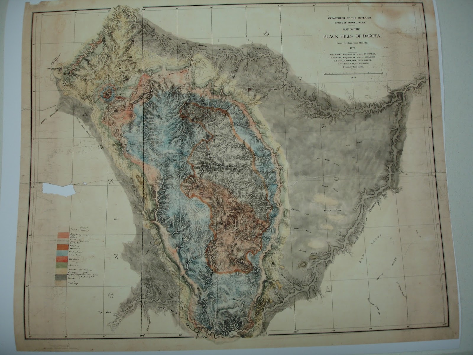
 |
| Geology 1875, photo courtesy of Don Simons |
 |
| Dakota Territory on map of the west, graphic courtesy of Don Simons |
 |
| Burt's Solar Compass, photo courtesy of Don Simons |
Burt's Solar Compass, an improved surveying tool was used. This tool determined the position of the sun, and occasionally the moon, with astronomical tables to run more accurate lines.
In 1861 the Homestead Act was in the works with the restriction that a survey had to be done before allowing any patents on the land, so the Federal Gov't want a survey done ahead of the passage of the Homestead Act. The Homestead Act was signed by President Lincoln on May 20, 1862.
Surveying was often difficult. In 1877, a 15 man survey crew, including brush clearers and cooks, took gunshots. They quickly packed up to go back to their wagons but found the wagons burnt when they arrived. They lost the engineers main field notes in the fire, but luckily the engineering assistant had a back up version. They headed towards Spearfish after the attack and encountered soldiers about 5 miles out, then continued to Spearfish to get reinforcements.
 |
| Mine Surveyors, photo courtesy of Don Simons |
 |
| Field Surveyors, photo courtesy of Don Simons |
 |
| Survey Family, photo courtesy of Don Simons |
The pay for the Engineering company for the 1877 survey was $6 per mile for prairie and $10 per mile for mountain terrain.
Townships were surveyed at 36 miles square.
 |
| Black Hills Meridian, graphic courtesy of Don Simons |
The Black Hills Base Meridian line was established along the Wyoming-South Dakota border at milespost 69 on Aug 13, 1878.
 |
| BHM Initial Point, photo courtesy of Don Simons |
 |
| Reeves' Int. Point, photo courtesy of Don Simons |
Tools improved throughout the years and calculators were lugged around for basic mathematics. Calculations of trigonometry were manual until 1972 when Hulett Packard introduced the HP-35 for $400.
 |
| Compass, photo courtesy of Don Simons |
 |
| Alladad, photo courtesy of Don Simons |
 |
| Roach Transit |
 |
| SAHS members with surveying tools |
 |
| Surveying tools display |
 |
| Trimble SX10 Total Station |
 |
| calculators used by surveyors |
 |
| on the left is a Hulett Packard HP-45 |